 NimbuScope
The idea
The clouds that hide a sunset are far away
Already know cloud horizon distance? Skip to the app
At sunrise and sunset the light reaches you almost flat, skimming the horizon. Because the Earth is curved, each cloud layer meets your horizon at its own distance. Seen from 40 m above the sea, low clouds meet it about 75–125 km away, mid clouds at 160–230 km, high clouds from about 280 km.
A bank sitting there, on the line of the sun, hides it even when the sky above you is clear. High clouds never block the sun: when the light gets under them, they light up. What counts is what lies on that line, layer by layer, minute by minute.
NimbuScope grows out of Clouds Horizon Distance, Francesco Gola’s free plugin for Windy. The app runs the same check for every minute, along the real ray and over the real terrain. On the blog: how the plugin works and how to use Windy for landscape photography.
How it works
From your spot to the sun, one minute at a time
-
Pick your spot
Drop a pin where you’ll set up the tripod. The app finds where the sun rises and sets from there.
-
Follow the ray
NimbuScope traces the sun’s ray from your pin through the low, mid and high clouds of the forecast.
-
Read the verdict
For every minute of sunrise and sunset, the app tells you if the light reaches you, and which clouds stop it when it doesn’t.
In the app
One sunset, five views
Five ways to read the same sunrise or sunset. Move the time and every view follows it, minute by minute.
-
Map
Your spot, the line of the sun and a ring for each cloud layer: where low, mid and high clouds meet your horizon. Move the time and the rings follow the sun, minute by minute. Show one layer at a time, or none, and check where rain is forecast.
-
Panorama
The real view from your tripod, rebuilt from elevation data: the skyline toward the sun with its hills, mountains and islands, and the forecast clouds placed over it. Move the time and the sun slides along its true path. It shows where the sun goes down, behind land or sea, and until when you can see it.
-
Section
The ray seen from the side, over the curve of the Earth, the real terrain and the forecast clouds. The cut always points at the sun: as the sun moves, the section turns with it, and the ground and the clouds along it change. You see the light pass, or the exact cloud that stops it and how far away it is.
-
Verdict and timeline
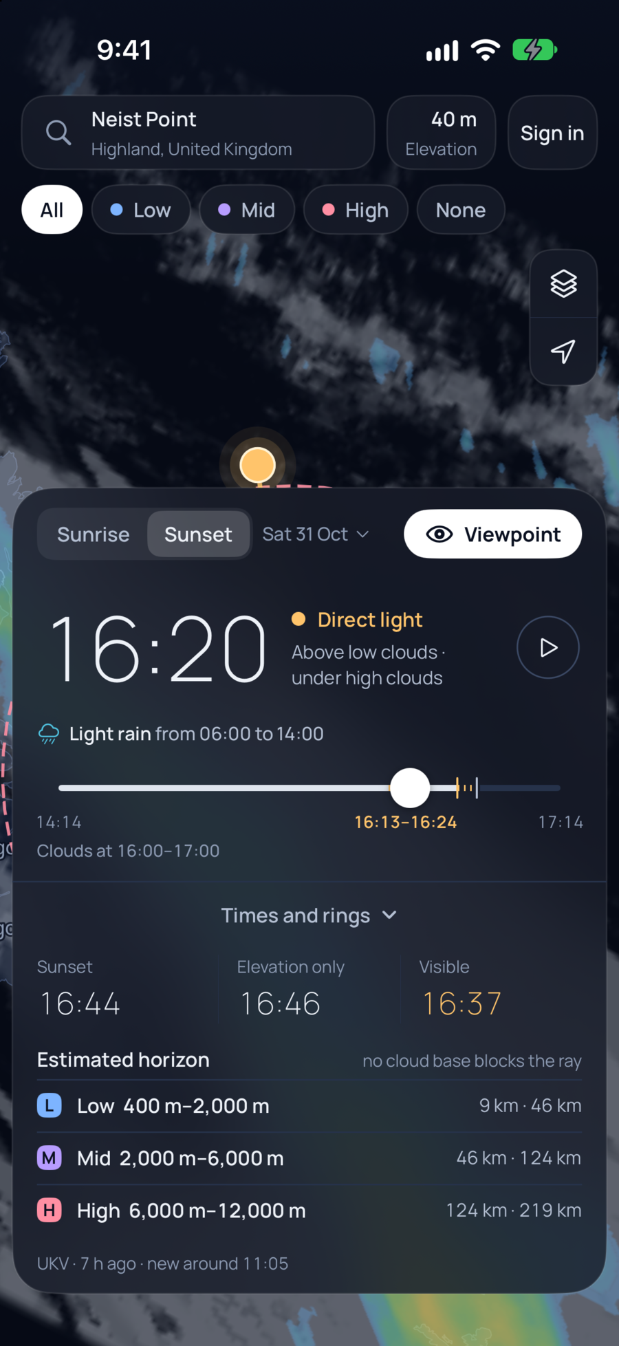
Direct light or blocked, for every minute of sunrise and sunset. The orange band on the timeline marks the minutes of light. Times and rings adds sunset, the visible time and the distance of each layer.
-
Models
Which forecast model the app uses at your spot, and what the others say. Here UKV at 2 km sees a bank of low clouds 46 km away that ICON-EU at 7 km doesn’t. Switch model and the verdict, the minutes of light and the clouds on the map change with it. Pick one yourself or leave it on automatic, which uses the finest model that covers your spot. The app also tells you when the next update arrives.

The panel
Everything under control
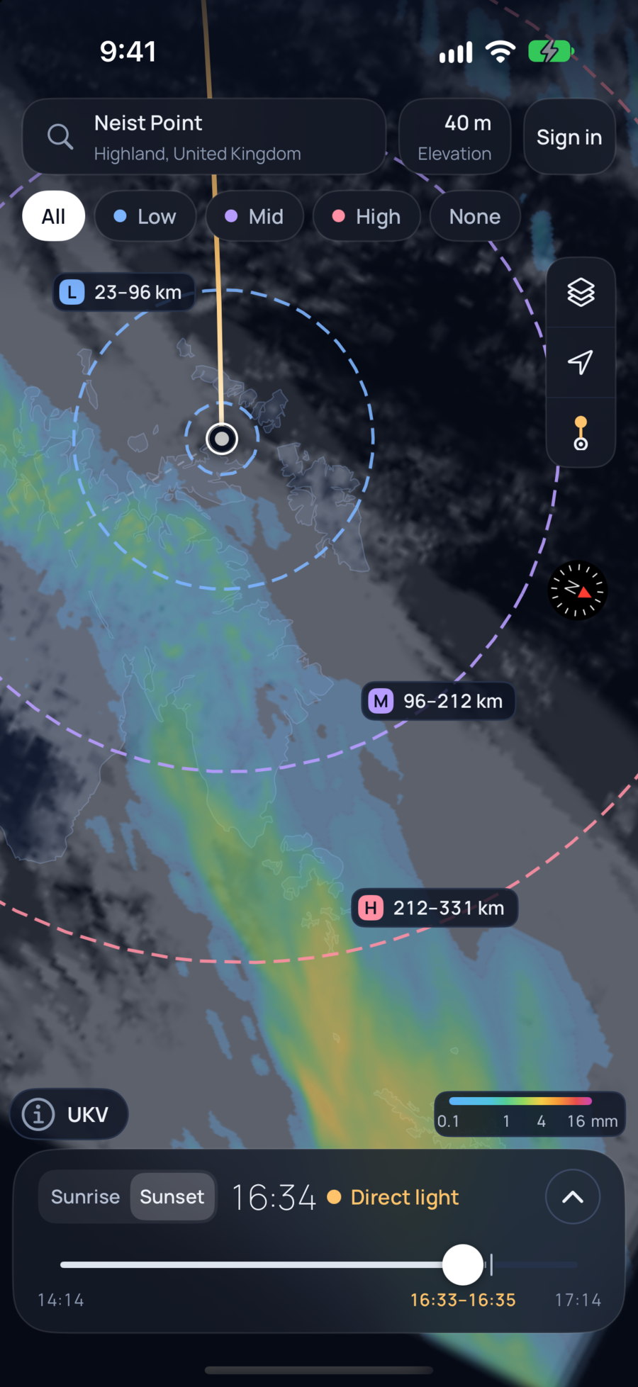
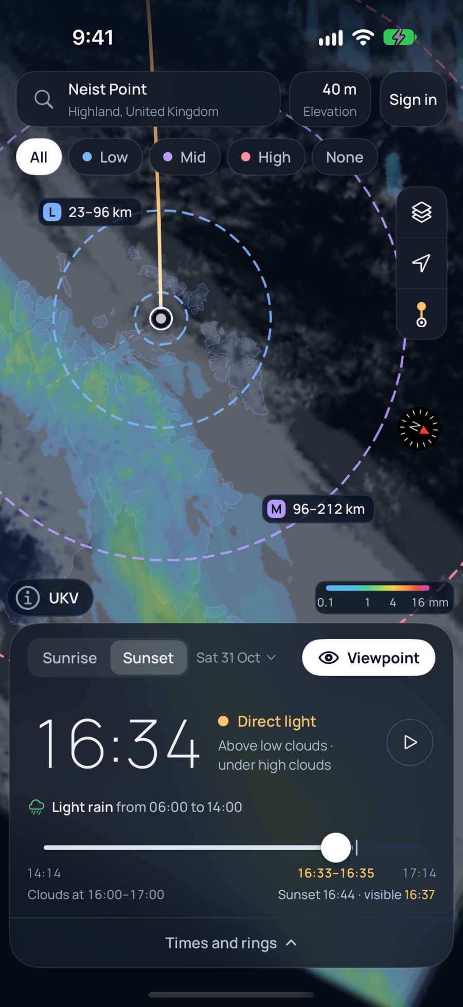
On the map, the panel has three sizes. Swipe it down to see more of the map, swipe it up for every detail.
-
Minimal
A thin bar with the time, the verdict and the slider. The map gets almost the whole screen.
-
Standard
The time, the verdict with the clouds behind it, rain and the slider. Viewpoint opens the panorama and the section.
-
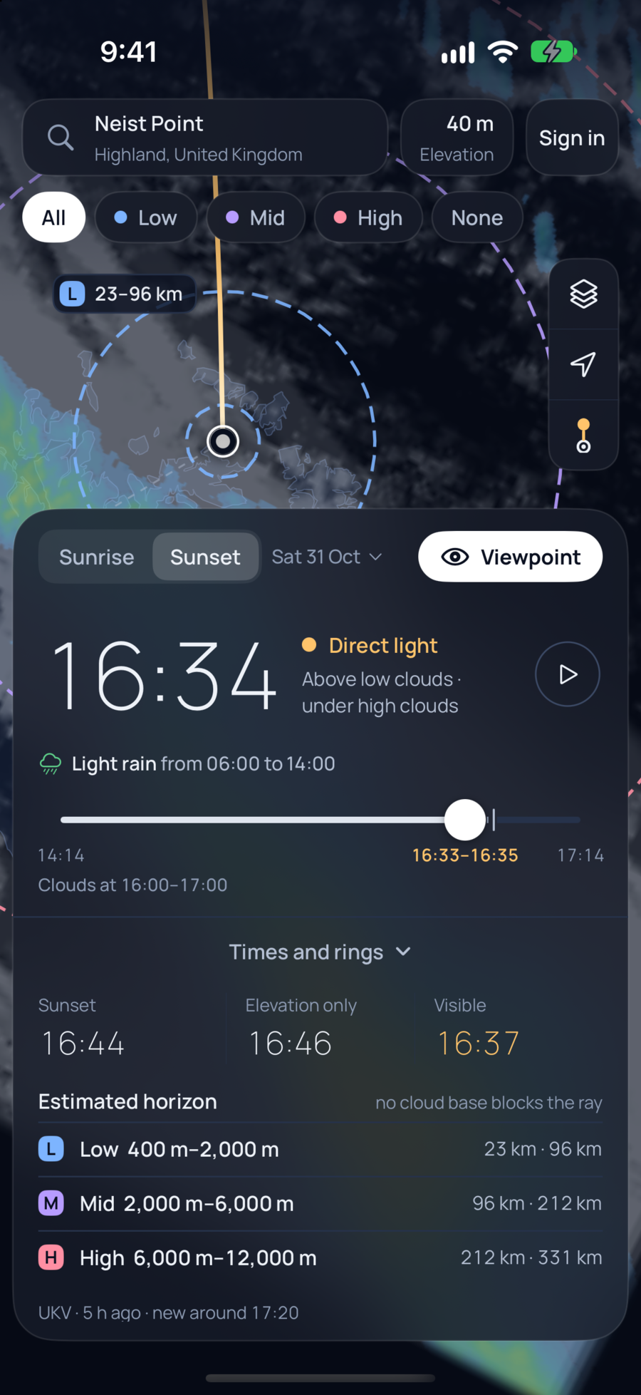
Extended
Times and rings: sunset and the last minute you can see the sun, and how far away each cloud layer meets your horizon.


Coverage
Where it works
NimbuScope reads the cloud layers of three weather models. Each covers its own region, at its own resolution.
- ICON-EUDeutscher Wetterdienst7 kmEurope
- UKVMet Office2 kmUnited Kingdom and Ireland
- HRRRNOAA3 kmUnited States
A new forecast every 3 hours Eight updates a day, for ICON-EU, UKV and HRRR alike.
New models are on the way We’re constantly working to bring more weather models into NimbuScope: more places, finer detail.
From the field
Shot before NimbuScope existed
These photos were taken before the app existed. We put the clouds of that moment into today’s engine and asked it the same question: would the light get through? It answers the way the camera did.
NimbuScope’s rules aren’t guesswork. We tuned them on real sunrises and sunsets, and we keep testing them against thousands of minutes of sunshine measured by weather stations, and against direct field observations.



Made by a photographer
“I photograph the sea at sunrise and sunset. Forecasts told me how cloudy the sky would be, and I needed to know if the sun would reach my tripod. So I built NimbuScope.”
Francesco Gola, seascape photographer
Francesco is a seascape photographer from Italy. For more than ten years he has taken people chasing the light along the sea cliffs of Europe and beyond, from the Lofoten Islands to the Cinque Terre. Before NimbuScope he built Clouds Horizon Distance, a free plugin for Windy. francescogola.net
Waitlist
Get NimbuScope first
Coming soon on iPhone and Android. Leave your email and we’ll write to you the day it’s out.
Emails about the beta and the launch. No spam. Privacy

